Frozen Ground & Permafrost
Science
How does permafrost form?
When ground temperatures drop to 0°C (32°F), the water trapped in sediment, soil, and pores of rocks turns to ice. Once frozen, it is considered frozen ground. When ground remains frozen for at least two consecutive years, it is known as permafrost. Ground that freezes and thaws every year is called seasonally frozen.
When referring to frozen ground thawing, scientists do not use the word melt, which means a solid becoming a liquid. When frozen soil thaws, it is still solid.
Impact on weather and climate
Frozen ground and permafrost affect both Earth's weather and climate.
Surprisingly, seasonally frozen ground makes the air a little warmer than it would be otherwise. When the soil freezes during winter, it releases heat to the atmosphere because water releases heat when it changes from liquid to solid ice. This is known as latent heat release. Soil can also store heat from the sun. Frozen soil releases more of this heat than soil that is not frozen because frozen soils conduct heat better.
Frozen soils also help hold moisture and are waterproof. They can act like a concrete layer, especially when the soil is saturated with ice. A thin layer of frozen soil stops moisture in the layers below from evaporating. So frozen ground helps regulate the water cycle.
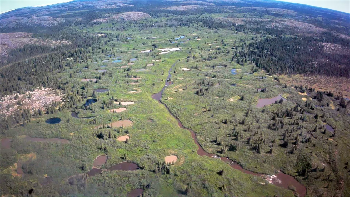
Permafrost also affects how much moisture is present in an area. Permafrost areas have many wetlands. Water on the surface, from melting snow and summer rains, cannot get through permafrost. The top layer (or active layer) of soil may thaw and let water through. But underneath it, the permafrost acts like a waterproof barrier. Then shallow ponds, lakes, and marshes commonly form in the summer. These wetlands are important to the plants and animals that live in permafrost areas. Many areas with permafrost get very little rain and snowfall. Without permafrost, water would soak in or run off the land, and the region would become very dry.
Permafrost and the carbon cycle
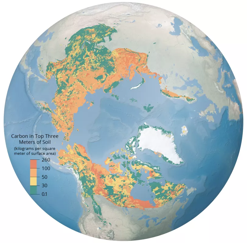
Frozen ground affects how carbon cycles through an ecosystem. Soil normally releases carbon into the atmosphere. This carbon comes from decaying plant and animal matter in the soil. If frozen soils are cold enough, they will stop releasing carbon, trapping more carbon in frozen ground.
Some carbon has been trapped for hundreds of thousands of years in frozen ground. This occurred during a period of Earth's history called the Pleistocene characterized by a series of ice ages, which began 2,500,000 years ago and ended about 12,000 years ago. The oceans contained less water, and ice sheets and glaciers were much thicker and covered a much larger area than they do today. However, there were also intervening warm periods called Interglacials. Some of the ground that froze during the cold periods is still frozen. It is called relict permafrost. Some places along the Arctic continental shelves that are covered in the ocean today were exposed to the ground then. The exposed ground froze, and stayed frozen, even when the climate changed and covered them in water, becoming subsea permafrost.
Layered Earth: Properties of frozen ground
The density of frozen water
When water freezes, it expands, meaning liquid water takes up more space once it has turned to ice. Therefore, ice is only about 90 percent as dense as water, so it floats. Just like ice cubes in a water glass float, so does the ice on a lake, and the same is true of icebergs.
When water turns into ice in the soil, it expands with great force, causing the soil to swell.
Communities that live in places with extremely cold winter seasons know that frozen ground can damage roads. For example, water turning to ice under roads sometimes creates a frost heave: The expanding ice pushes up the road and creates a hump. When water freezes and then melts, it helps create potholes and sunken sections in a roadway.
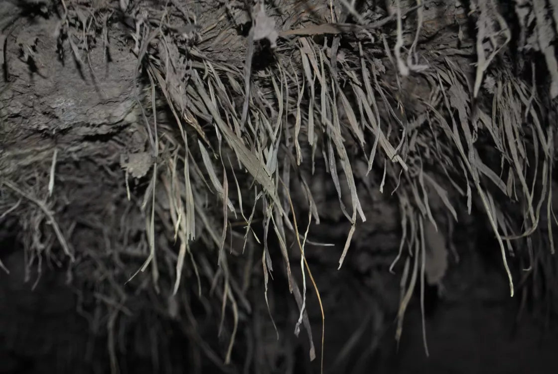
Sometimes, in very cold places, a layer of pure ice forms under the soil. This layer is called segregated ice—it is not mixed in with the soil. Segregated ice can be a few meters (up to 10 feet) thick. Segregated ice forms when pore ice, the frozen water that freezes in sediment and cracks within soil and rocks, attracts water, which freezes and attracts even more water. This effect is called cryosuction. Cryosuction makes the frozen layer grow, and the growing layer expands the soil even more. Cryosuction can make permanently frozen ground expand by 50 percent.
Distribution of temperature within soil
Layers deep within the ground may be colder or warmer than layers near the surface of the ground. The top layer typically responds to conditions on the surface, but the layers below may be slower to react. Take, for instance, a warm summer day, the near surface layer, usually thawed at this time of year, absorbs heat to become considerably warmer than the temperature a meter (a few feet) underground. In the winter, the opposite happens. The surface of the ground cools, but the layer deep underground may stay warmer than the surface.
This layering of temperatures is called a temperature gradient, and the flow of heat is always from high temperature toward low temperature. The summer temperature gradient in a cold place like in northern Alaska might look like this: The air temperature is above freezing, the ground surface is above freezing, but deeper layers of the ground are permanently frozen.
The type of soil in an area also affects how the ground will store heat. Loose soils like sand have more space for water. In loose soils with large particles, ice forms more easily. Dense soils with small particles do not have as much space for water. Therefore, clay does not freeze as easily as sand.
Depth of frozen ground
How deep the ground freezes depends a lot on how long the air above is cold. The longer the cold period, the deeper the ground will freeze. But the depth of frozen ground is limited because Earth is warm deep inside and conducts heat upwards.
Most of Earth's heat comes from the sun. The ground stores a lot of the sun's heat and reflects the rest into the air. Snow and ice are light colored and reflect more heat away. Ocean water and bare ground reflect less heat, instead absorbing it. This transfer of heat between the ground and the air is called the surface energy flux.
As just noted, heat is also coming from inside of Earth. Because of radioactive decay, the deep interior of Earth is lava hot, and this heat moves towards the cooler surface. This movement of heat to the surface is called the geothermal heat flux. The geothermal heat flux can stop the ground from freezing. Even in very cold areas, the ground can only freeze so far before the geothermal heat flux stops it.
Heat from volcanoes, rivers, lakes, and other sources can also spread through the ground. This heat keeps some areas unfrozen, even though surface temperatures are low.
In general, deeper permafrost is older than shallower permafrost. One researcher found that the deepest part of the permafrost underneath Prudhoe Bay, Alaska, has been frozen for more than 500,000 years.
Landscape features
Frozen ground freezes and thaws, creating various distinctive landforms. Some of these features are specific to permafrost.
Needle ice
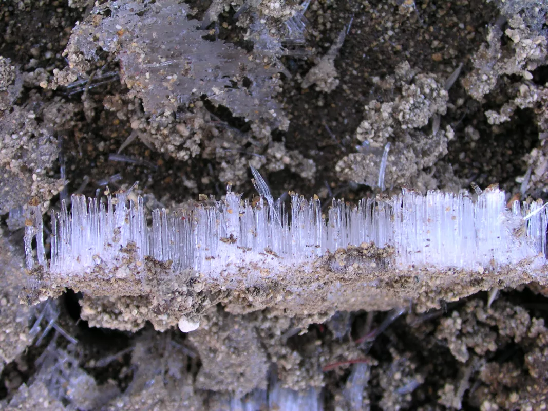
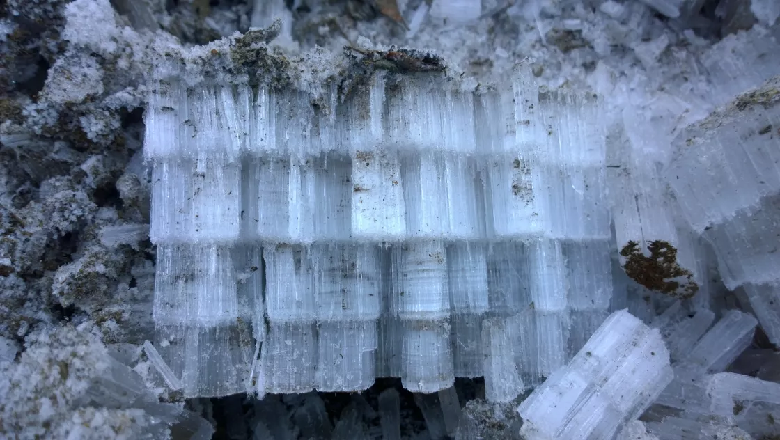
Needle ice can form any place where the ground freezes. Needle ice forms when the ground is saturated, then freezes rapidly. The ice crystals grow upward, starting a few centimeters (inches) underground. If the air stays cold enough, needle ice can grow 40 centimeters (16 inches) long.
Patterned ground
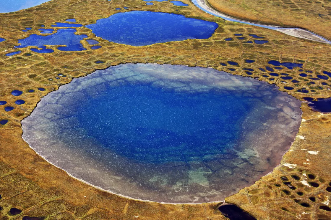
In the Arctic, giant areas of circles, stripes, polygons, or other shapes form on the land. These areas are called patterned ground. Patterned ground forms when water and ice in the ground move the rocky soil around.
Ice wedges
Giant towers of layered ice can form from small cracks in the ground that keep getting bigger. These towers are called ice wedges. To see how ice wedges form, watch Patterned Ground: How Permafrost Ice Wedges Cause Tundra Polygons and Mounds.
Pingos
Pingos are small hills with ice cores. Pingos form when thick underground ice pushes up the top layers of soil. They range in height from 3 to 70 meters (10 to 230 feet) and 30 to 1,000 meters (100 to 3,300 feet) in diameter. They are typically cone-shaped, appearing sometimes with a depression on top, like a volcano. Pingos only form in permafrost, so a collapsed pingo suggests a former permafrost environment.
Palsas
Palsas are hills similar to pingos, but smaller, that typically occur in wetland areas. Palsas form when ice attracts liquid water.
Rock glaciers
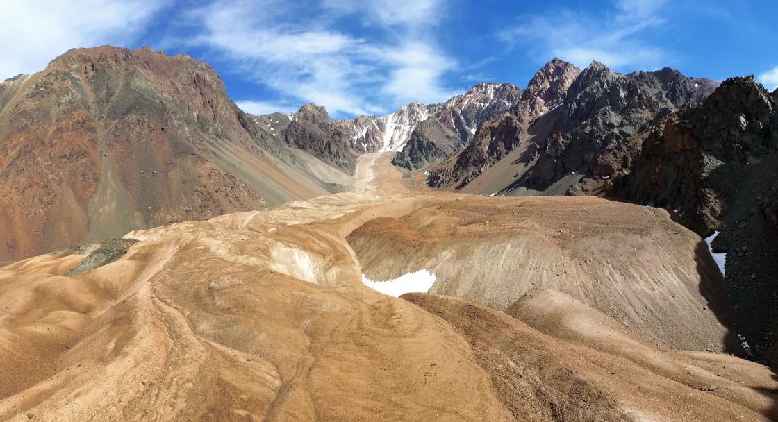
Rock glaciers are rivers of rock, dirt, and ice, which slowly flow downhill. Rock glaciers are different from ice glaciers because they form from material on the ground. Ice glaciers form when snow falls on the ground and compresses into ice over many years.
Thermokarst lakes
Thermokarst lakes form when permafrost thaws and releases water. Ice melting beneath thermokarst lakes causes the lakes to deepen over time.
Hummocks
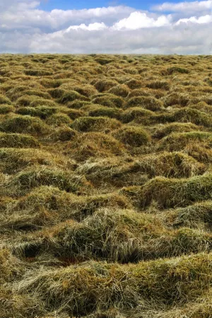
Hummocks form in areas with dense soil that has small particles, like clay soil. When the water in the soil freezes and thaws, it can push up smooth lumps of soil. Hummocks often form in large groups. They can form whether or not there is permafrost underneath.
Thufur
Thufur are huge hummocks that last from year to year. They can be more than half a meter (1.6 feet) high. Thufur form in either the active layer in permafrost areas, or in the seasonally frozen ground in non-permafrost areas, during freezing of the ground.
Types of permafrost
Continuous permafrost
Continuous permafrost exists under almost the entire land surface in an area (90 to 100 percent of the landscape). Areas with continuous permafrost often have permafrost layers more than 100 meters (330 feet) thick. The deepest permafrost ever found is in Siberia, a region in northern Russia. One area in Siberia has a permafrost layer that extends down 1,650 meters (5,410 feet).
Discontinuous permafrost
Discontinuous permafrost exists under a large portion of a particular area or only in a few specific places, underlying 50 to 90 percent of the landscape. Alpine permafrost is discontinuous permafrost that exists on the tops of mountains, where the ground stays very cold. In areas with discontinuous permafrost, the permafrost layer may extend as deep as 10 meters (33 feet) underground. Taliks are sections of unfrozen ground within permafrost.
Sporadic permafrost
Sporadic permafrost means 10 to 50 percent of the underlying surface has permafrost.
Isolated permafrost
Isolated permafrost means less than 10 percent of the surface has permafrost under it.
Subsea permafrost
Despite its name, subsea permafrost does not form under the ocean. It does, however, exist beneath the seabed and in the continental shelves of the polar regions. Subsea permafrost refers to permafrost that formed on land during the Pleistocene ice ages, when a larger portion of Earth’s water was trapped in massive ice sheets, which led to lower sea levels. As the ice sheets melted, land was inundated as sea level rose to 390 feet (120 meters) starting about 18,000 years ago.
Research & data
Scientists use many different methods to study frozen ground from space to in the field. Scientists verify satellite information by comparing it to what they have learned from field studies. Other scientists work in laboratories, experimenting on frozen ground. Indoors, scientists can control conditions and study the processes that happen when the ground freezes. For example, they can study how quickly water freezes in different soils.
Using computers, scientists can model frozen ground conditions by including information from field work, satellites, and the laboratory. Experts can test ideas, tweak variables, and make predictions of what will happen to frozen ground in the future. For example, they can explore how permafrost may react to increases in air temperature.
Eyes in the sky: satellite observations of permafrost
Permafrost is hard to see. Relying on field observations alone is difficult, if not impossible. Satellites provide daily data spanning the globe.
However, current satellite sensors cannot peer deeply into the ground. Instead, scientists study the landforms that are associated with ground areas. Permafrost landscapes form recognizable patterns, such as palsas and pingos.
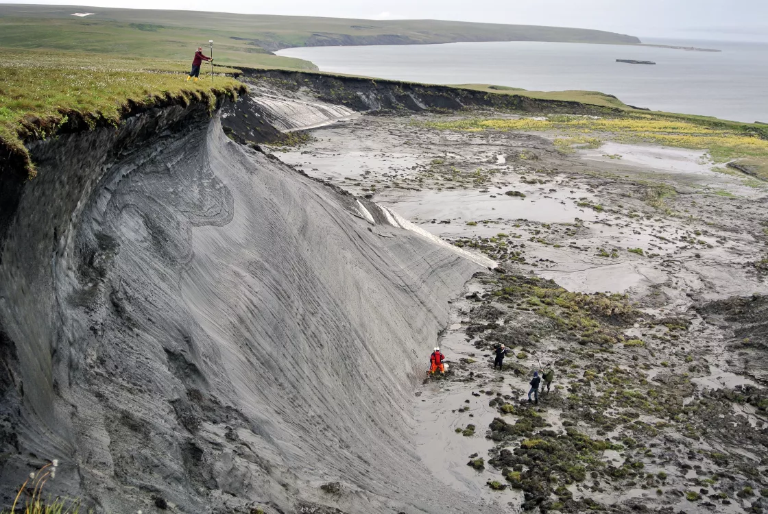
Changes in these landscapes, therefore, can also be a sign of warming. Specifically, scientists look for active-layer detachments, retrogressive thaw slumps, degraded ice-wedge polygons, and thermokarst lakes as symptoms of permafrost thaw.
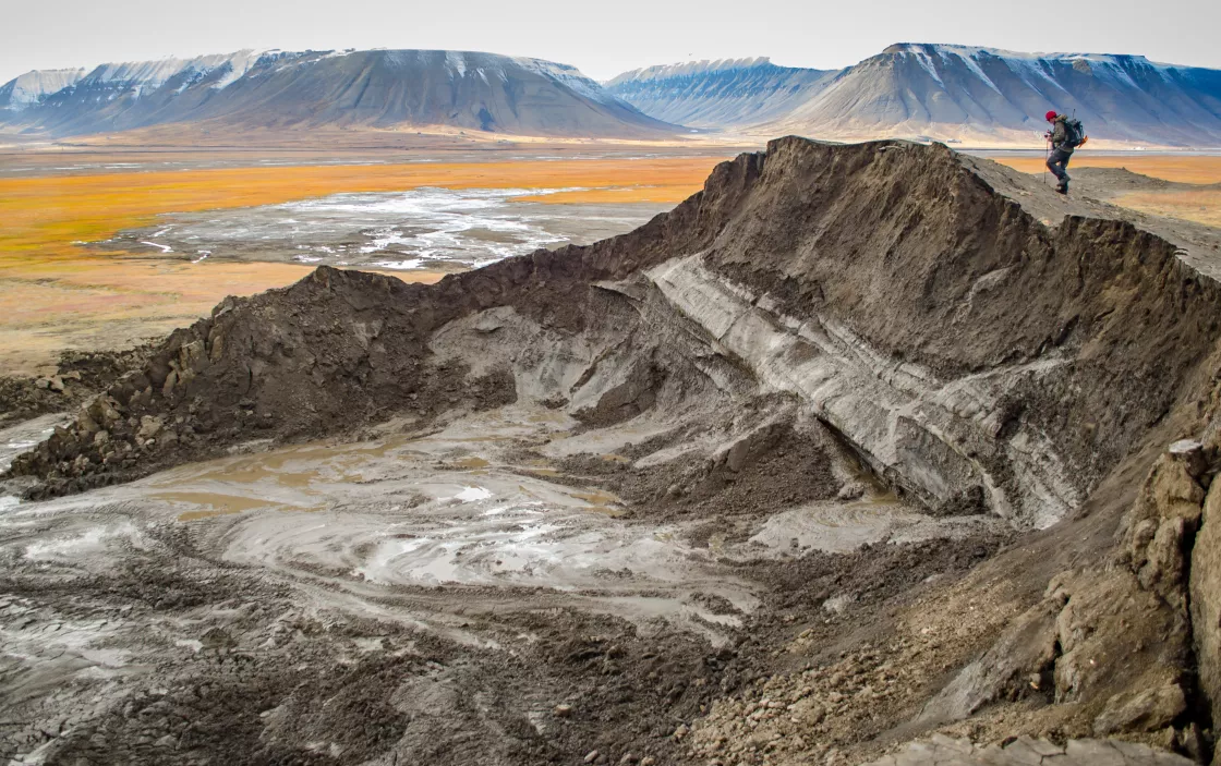
- Active-layer detachments are small landslides that occur in the summer or on thawing permafrost.
- Retrogressive thaw slumps occur when a slope fails because ice-rich permafrost advances into undisturbed ground as material thaws.
- Ice wedge polygons are cracked permafrost shaped into polygons. They are formed by contraction of frozen ground in the winter, after which liquid water in the ground freezes and expands to form cracks in the surface.
- Thawing ground ice can gradually cave in, a process known as thermokarst that results in irregular surfaces of marshy bowls.
Satellite data can also inform scientists about the surface temperature on the ground and whether water near the surface is frozen. Scientists verify the satellite information by comparing it to what they have learned in the field. The NASA Soil Moisture Active Passive, or SMAP, satellite orbits Earth measuring the amount of water in the top 5 centimeters (2 feet) of soil. SMAP can decipher whether the soil is frozen or thawed.
Scientists also use the NASA gravity-detecting Gravity Recovery and Climate Experiment (GRACE) satellites to trace changes in groundwater reservoirs that may indicate thawing permafrost.
In the field: techniques to measure permafrost
Scientists gather information in the field on ground temperature, frozen ground depth, and moisture. This information is useful to understanding how frozen ground forms and changes. For example, with this information, scientists can get a good idea of how permafrost is changing over time. Scientists monitor the thickness of the permafrost active layer temperature, and the amount of groundwater.
Scientists working in the field drill holes and insert instruments to take measurements underground. Temperature and moisture sensors give information at various depths. Researchers try to disturb the ground as little as possible while they work. However, drilling creates heat. So, scientists use protected pipes and blow cold air into the drill hole. These efforts keep the ground from thawing and keep the measurements correct.
Scientists have set up monitoring sites across areas of permafrost in the Arctic. These sites collect data over many years. Some sites were established back in the 1840s. The long-term data help scientists understand the permafrost's history, as well as its possible future.
Frozen ground data
Frozen ground data is critical to understanding environmental change, validating models, and building and maintaining structures in seasonal frost and permafrost regions. Climate models and observations both point to increased permafrost thawing in the twenty-first century.
Browse related open access data collections archived at NSIDC
Aquarius data collection
The NSIDC DAAC Aquarius collection includes global gridded soil moisture data and additional polar gridded products. These data products are derived from observations by the Aquarius microwave radiometers and scatterometer on the joint U.S./Argentinian Satélite de Aplicaciones Científicas (SAC-D) platform. The Aquarius/Satélite de Aplicaciones Científicas (SAC)-D mission collected observations between August 25, 2011, and June 7, 2015. On June 8, 2015, a power failure on the SAC-D spacecraft ended the mission's observations.
Cold Land Processes Field Experiment (CLPX) data collection
The NSIDC DAAC CLPX collection includes data products from the NASA-NOAA Cold Land Processes Field Experiment (CLPX) and includes measurements of brightness temperature, albedo, visible and infrared imagery, snow characteristics, vegetation, soil moisture, and meteorology. Conducted primarily between the winter of 2001-2002 and the spring of 2003, CLPX took place in the Central Rocky Mountains of Colorado.
Making Earth System Data Records for Use in Research Environments (MEaSUREs) data collection
The NSIDC DAAC Making Earth System Data Records for Use in Research Environments (MEaSUREs) data collection includes data products derived from satellite data and created by researchers. These data products encompass snow, sea ice, glaciers, ice sheets, ice shelves, and freeze/thaw conditions, snow, and brightness temperatures. Spatial coverage ranges from global to continental, and temporal coverage ranges from the 1960s through the present.
SMAP (Soil Moisture Active Passive Data)
The NSIDC DAAC SMAP data collection includes data products derived from an L-band radiometer and high-resolution L-band radar instrument that make up the orbiting observatory of the Soil Moisture Active Passive (SMAP) satellite mission. The orbiting observatory measures surface soil conditions everywhere on Earth every two to three days, distinguishing between ground that is frozen or thawed.
